
Search Lancaster Streets by Address
A street search in Lancaster works best as a short evidence trail, not as a list of everyone at a road address. Begin by standardizing the delivery address, then use the Fairfield County Auditor record to find the parcel and assessed owner. The parcel identifier connects the address to the GIS map and to recorded land documents. A recorded owner can be a solid land-record lead, but it does not prove that every person at the location lives there. The same restraint applies to a mailing address on a tax record.
- Check the full delivery address with the USPS ZIP Code Lookup, then enter House #, Direction, Street Name, and Street Type in the Fairfield County Auditor search.
- Save the returned PIN or PARID, the situs address, the assessed-owner field, legal-description fragments, and any Book/Page or instrument lead. Those are the bridge keys for the rest of the address trail.
- Use the county GIS parcel map to identify the correct polygon and distinguish the physical site from a tax-mailing address. Review nearby parcels separately rather than treating a road as one record.
- Move Book/Page, instrument number, legal description, party name, or date into the Recorder index. Fairfield AVA has no street or parcel search field, so the parcel work comes first.
- If a specific name is now relevant, use Ohio's name-and-county voter lookup and its later street narrowing only as a single-registration check. For older household context, ask a local collection about a dated directory or newspaper source.
The county records hub links the separate land, court, property, and request systems. Its warning that some records are not online matters: a no-result in one interface is not proof that an earlier Lancaster record never existed.
Note: Keep the search date and each parcel identifier with your notes, because a street can cross municipal, township, subdivision, or tax-district lines.
Lancaster Street Directory Coverage
These address-keyed sources have different strengths. The Auditor and GIS give the clearest starting point for a present-day parcel. The Recorder supplies the recorded instrument trail after a parcel has yielded useful identifiers. City Building and Code records require a defined address and time period because no verified public, by-address permit-history database was located. Ohio's voter system is a name-led verification route, not a road-browse roster.
| Address Record | Lancaster Keeper | Useful Result | Access Route |
|---|---|---|---|
| Parcel assessment | Fairfield County Auditor | Owner, parcel, sales, assessment, and property-card leads | Componentized address search |
| Parcel GIS | Fairfield County GIS | PIN/PARID, situs, mailing, legal, sale, and map fields | Parcel layer and viewer |
| Recorded land papers | Fairfield County Recorder | Deeds, liens, plats, parties, dates, and legal descriptions | AVA index, counter, or historic guide |
| Building or code material | City Building or Code Enforcement | Defined project, inspection, or complaint-process records where public | Form, counter, or narrow request |
| Voter registration | Ohio Secretary of State and Board of Elections | Limited public registration confirmation for a named voter | Name, county, then available street narrowing |
The division between owner, physical location, and mail route is the central address-record limit. The tax payer can use a post office box, agent, business, or another address. A transfer field can suggest a deed to inspect, but only the recorded instrument and its legal description establish what was conveyed.
Lancaster Auditor Street Fields
The Auditor's public real-estate form is built for componentized queries. Try the address parts as recorded, especially the direction and street-type abbreviations. When a search does not return the parcel, use the owner or parcel number as a separate route. The advanced form also has sale, location, legal, land, and residential groups, but it does not offer a ZIP field. A result is a property record, not a directory of people.
| Auditor Label or Group | How It Helps a Street Search |
|---|---|
| Owner Name (Last First) | Tests an assessed-owner name after the parcel is identified. |
| Parcel Number | Returns to the exact county property record. |
| House #, Direction (Abbv), Street Name, Street Type (Abbv) | Supplies the actual address components for the first query. |
| Sales | Includes sale-date, sale-price, buyer, seller, and valid-sale criteria. |
| Location | Offers Tax Districts, City/Township, School Districts, Neighborhoods, and Subdivisions. |
| Legal, Land, and Residential | Provides legal-description, acreage, and building-characteristic criteria. |
For a view of the county parcel schema, see the Fairfield GIS parcel-boundary layer.
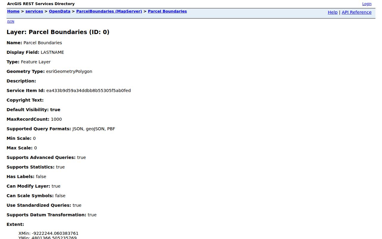
The process uses these separately labelled fields to avoid confusing a site address, a tax-mailing destination, and the recorded owner.
Lancaster Parcel Viewer Street Layers
Fairfield County's Auditor-owned Parcel Viewer Web Map V2 provides the map part of a street search. Its published layers include Addresses, Corporation Boundaries, Roads, Parcel Boundaries, Tract Lines, and Neighboring Counties. The related county map service adds subdivision and township boundaries. Those layers explain why a Lancaster-looking address may need a county-office route or why a road search changes at a corporation or township line.
Select the relevant parcel, preserve its PIN or PARID, and use the legal and transfer fields to return to the Auditor or Recorder. The GIS service supports query, map geometry, ordering, filtering, and pagination, with a maximum response of 1,000 records. That response cap is another reason not to turn a broad map result into a complete road-by-road result.
Open the Fairfield County Parcel Viewer Web Map V2 to see the published parcel-map framework.
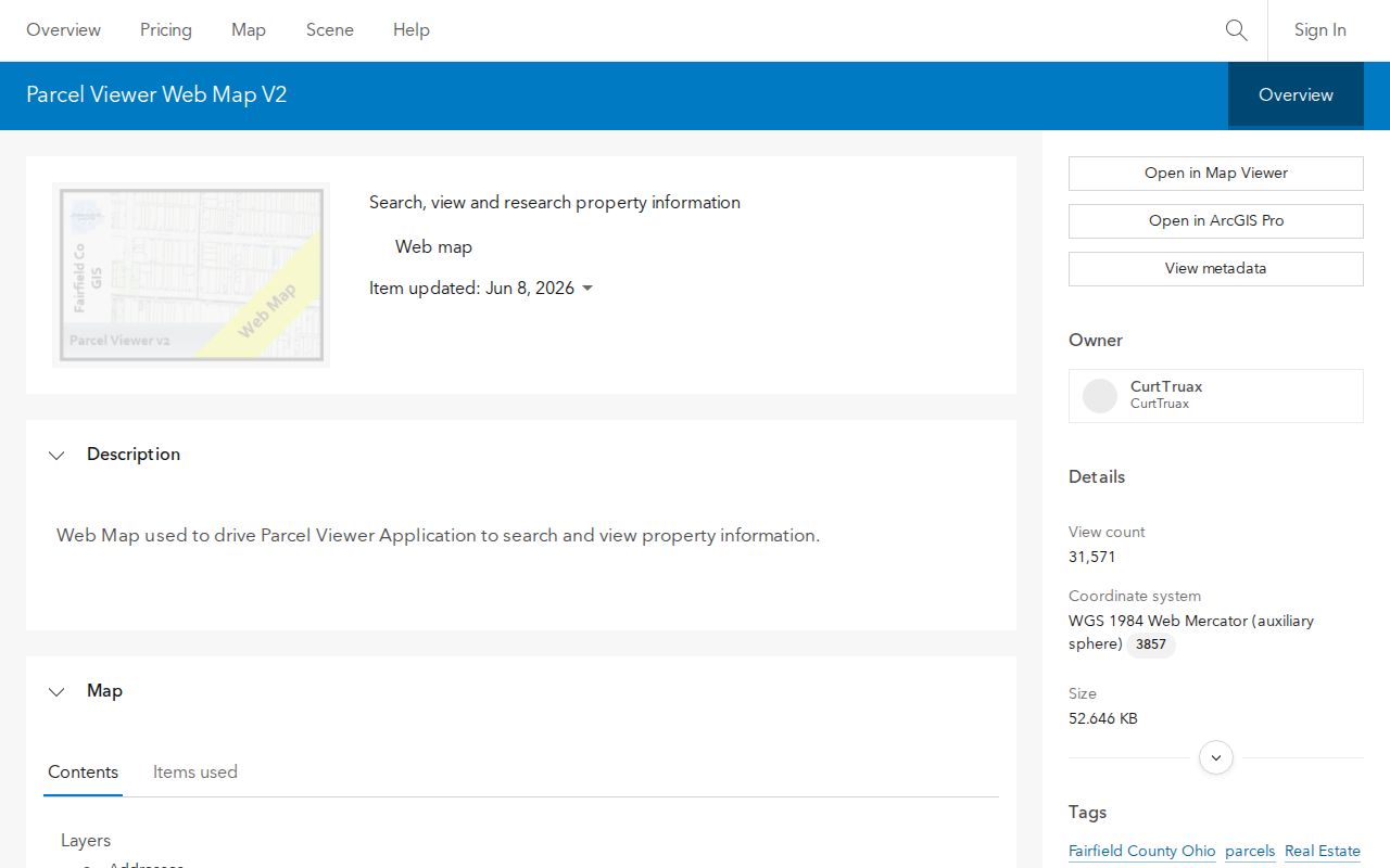
The map is most useful for confirming the parcel shape and nearby geography before a land-record search, not for deciding who occupies a street address.
Note: A subdivision label is a map and legal-description clue, not proof of a community roster or a person's membership.
Lancaster Parcel and Mailing Keys
Field labels are evidence categories. The GIS layer distinguishes PADDR1 and the component situs fields from MADDR1–3 and MZIP1, which carry tax-mailing information. It also separates the legal-description fields LEGAL1–3 from the PIN/PARID cross-system identifiers. A strong address trail records each category without silently replacing one with another.
- Parcel
- A county-defined piece of land represented by a PIN or PARID and mapped boundaries.
- Situs address
- The physical property location used for an Auditor, GIS, or City request.
- Legal description
- The lot, subdivision, acreage, or other land wording that connects a parcel to a recorded instrument.
- Plat
- A recorded map that can bridge lots, blocks, subdivisions, and street names.
- Criss-cross directory
- A historical directory arranged by address rather than name; no Lancaster holding was confirmed, so ask a collection about a specific edition.
A parcel can contain more than one structure or address. For that reason, match the legal description and recorded paper before combining an old source with a current street number.
Lancaster Deed Trail by Street
After the Auditor and GIS work produces a Book/Page, instrument number, party, date, or legal-description lead, use the Fairfield County Recorder AVA search. AVA accepts party name, document number, document type, date range, Book/Page, and Subdivision Name. Its result headers include document number, type, recorded date, two party fields, and legal information. It does not accept a Lancaster street address or a parcel number as a configured search field.
Read the current deed's grantor, grantee, recorded date, legal description, and prior-reference information. Then search the prior seller as a later grantee or repeat the same legal-description trail. This is a chain of title, meaning the dated sequence of transfers tied to the land. It is not an occupant history. The Recorder cautions that online data is believed accurate but not guaranteed, historic index dates can be placeholders, and shielded documents may need Recorder contact.
The Recorder's Old Deed Index guide shows the historic bridge.
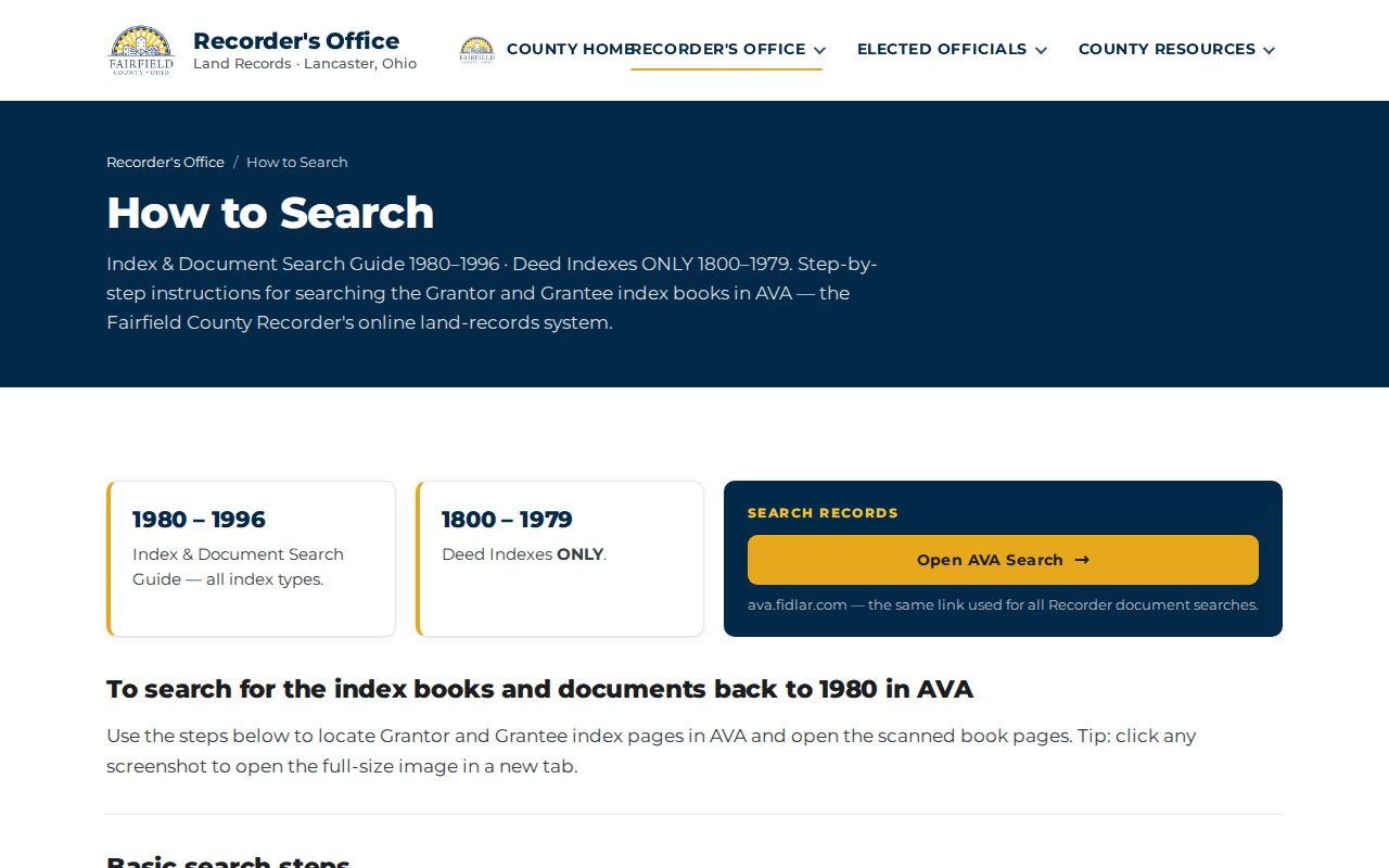
For the historic books, enter INDEX as the document type and a surname initial; GR points to grantor pages and GE to grantee pages, with key pages leading to the book and page.
Lancaster Building Records by Address
For a construction, zoning, inspection, or code question, route the request to the City office that holds it. The Lancaster Certified Building Department describes permits, plan-review forms, inspection contacts, and contractor registration. It says most new construction or remodeling needs a permit, while maintenance does not. Its forms can be used in person, by requested fax, or by download. No verified public address-history portal was found.
Give the office the exact site, approximate project period, and the defined record sought. A project application, permit, complaint, or notice can be a dated property clue. It does not establish that a listed contact lived at the address. For a City-held record outside the department's routine channel, the City public-record request form can clarify a narrow request under Ohio's Public Records Act.
See the Lancaster Building Department source page for the public access route.
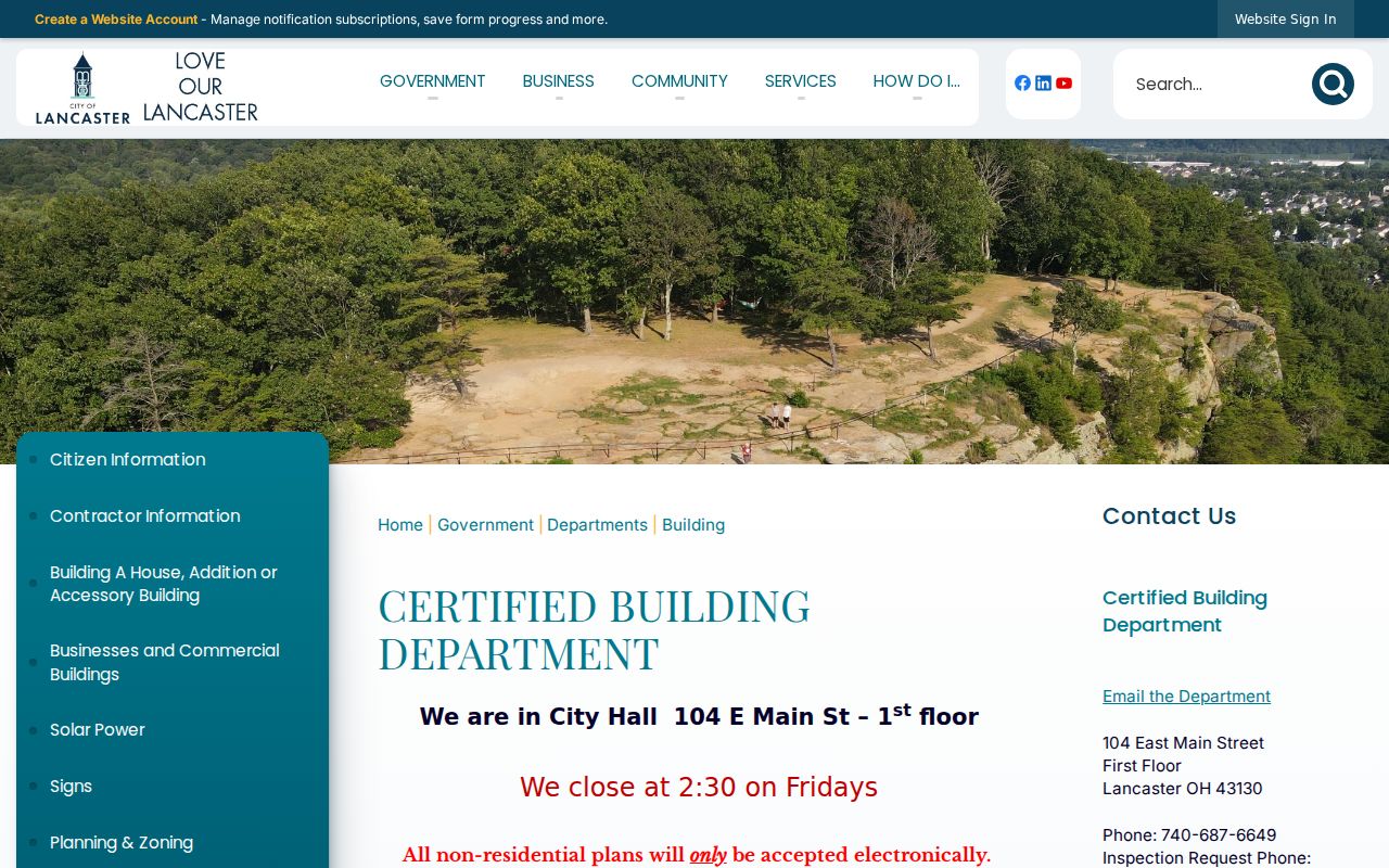
This City channel complements the county parcel and deed systems when the question concerns work at a specific location and date.
Lancaster Historic Street Names
Historic address research needs a date. City material identifies Front Street as today's Memorial Drive, while a separate, narrow City-code clue records Old Sugar Grove Road as Ford Street in the Meadowview/Floyd Terry area. Neither finding supports a citywide renumbering rule. Keep old and current names in the research log, then test them against a map, plat, legal description, dated directory, or recorded instrument.
The City's early history also uses the name New Lancaster before the legislature shortened it to Lancaster in 1805. That place-name variation can help with early sources, but it does not change a modern postal, parcel, or ownership record. For an older resident clue, the Lancaster city directories route is the appropriate historical shelf, subject to the collection's date and holding limits.
Note: A map or directory gives dated context for a street, while a recorded legal description is the stronger bridge across a changed address name.
Lancaster Voter Limits by Street
Ohio's My Voter Information form requires first name, last name, and county. It can later narrow by street, but it is not an open road-browse roster. Use it after a reliable, dated public record has narrowed a specific name. The public database fields identified by ORC 3503.153 include the elector's name, birth date, current residence address, precinct, registration date, voting history, and last activity date.
Several fields and records remain protected. Driver or state ID numbers, Social Security information, telephone numbers, and email are nonpublic. Safe at Home participants, protected voter records, sealed court material, adoption files, medical records, and motor-vehicle personal information do not become part of a street search. A maintenance page or a changed interface is also not evidence about a registration.
Lancaster Street Directory Limits
Property records, mapped parcels, and deeds can document land facts. They cannot supply a complete household list. Utility customer information is not a public resident roll, and motor-vehicle personal data is protected. A parcel can identify an assessed owner and a mailing destination, yet neither field proves who is present at the physical address on a given day. City records and historical directories each need the same source-and-date caution.
For an individual verification question, use the most relevant official source and keep the inquiry narrow. A street-wide property trail is different from a name-led check, which is why the Lancaster resident lookup route is separate. If an online index has no result, contact the custodian, Recorder, Clerk Records Division, library, or archive that covers the needed era rather than drawing a conclusion from the gap.