
What Lancaster Neighbors Records Show
The public block trail starts with land records, not a list of everyone who lives nearby. A parcel viewer can place the central lot beside adjoining parcels. The Auditor then supplies the public property card, while the Recorder connects a documented transfer to an instrument and legal description. Ohio voter information is a named-person check with required fields, not a block-browsing tool. Local organizations offer a contact or historical-research layer, not a roster of Lancaster neighbors.
| Source | Block Evidence | Best Access |
|---|---|---|
| Parcel Viewer and GIS | Adjoining parcel geometry, parcel IDs, owner, situs, mailing, legal and transfer fields | Public county map and parcel layer |
| Auditor property search | Seed address, assessed owner, parcel, assessment and sale facts | Address, owner, or parcel search |
| Recorder AVA | Named parties, instrument, recording date and legal-description trail | Use document, party, Book/Page or date criteria |
| Ohio voter lookup | A limited public registration verification for one named person | First name, last name, and county required |
| Local collections and City contacts | Historic maps, photographs, dated context, or engagement contact | Specific collection or contact request |
These sources must remain separate. An owner field does not establish an occupant, a tax-mailing field does not establish a home address, and an adjacent parcel does not establish a personal relationship. Keep each property record with its own PIN or PARID before drawing any comparison across a Lancaster block.
Map Lancaster Neighbors From a Central Parcel
Use the Fairfield County Auditor Real Estate Search to locate the starting address. Its basic address fields are House #, Direction, Street Name, and Street Type. Preserve the returned PIN or PARID, property situs, owner field, legal-description fragments, sale data, Book/Page, and instrument number. Then open the related parcel in the County’s viewer and inspect touching or nearby polygons one at a time.
- Enter the precise address in the Auditor search and save the central parcel’s PIN or PARID.
- Open the parcel in the map, then pan and identify each nearby polygon as a separate property record.
- For each parcel, record only its labeled fields: owner, physical address, tax-mailing fields, legal description, Book/Page, sale date, and instrument lead.
- Move a transfer question to the Recorder with the parcel identifiers or the recorded-document facts. Do not use a street-address search in AVA, because Fairfield AVA does not provide one.
Fairfield County’s parcel GIS service is the manifest source for the county parcel view.
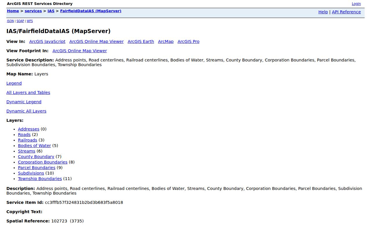
The parcel image helps establish the map-and-identifier starting point. It does not turn a group of property polygons into a current list of Lancaster neighbors.
Note: Save the central parcel’s PIN or PARID before comparing adjoining parcels, because each polygon has its own record trail.
Lancaster Neighbor Parcel Fields Stay Separate
The county GIS layer keeps several location concepts apart. `PADDR1` is the parcel’s physical or situs address. `MADDR1` through `MADDR3`, `MCITYNAME`, `MSTATECODE`, and `MZIP1` are tax-mailing fields. `OWN1`, `OWN2`, and `LASTNAME` are recorded-owner fields. `LEGAL1` through `LEGAL3`, map and acreage data, and the PIN or PARID describe the parcel’s legal and mapping trail. Transfer facts can include Book, Page, sale dates, price, sale type, and instrument number.
That separation is the core safeguard for a block search. A mailing field may point to an agent, business, post-office box, or another address. A parcel may contain more than one structure or address component. A sale field is a lead that should be checked against the deed, not a complete title finding. Reading the field labels rather than relabeling them as residents keeps the Lancaster neighbors search accurate.
- Parcel
- A mapped unit of land with county identifiers and property fields. It is not a list of everyone present at that location.
- Situs address
- The physical location assigned to the parcel or structure. It differs from a tax-mailing field.
- Legal description
- The land description used in a recorded instrument to match the same property across records.
Link Lancaster Neighbors Parcels to Recorded Transfers
After the map establishes a parcel, the recorded-document trail answers a different question. Fairfield County’s Ohio Land Records AVA index accepts party name, document number, document type, date range, Book/Page, and subdivision name. It does not expose active Fairfield address or parcel fields. Carry the Book/Page, instrument number, party names, date, and legal-description clues from the parcel record into the index.
AVA results can identify document number, document type, recorded date, Party1, Party2, and legal information. Opened details can include associated documents, location, notes, parcel, party, subdivision, and tract information. The Recorder cautions that indexing can be delayed and that online data is not guaranteed. Shielded documents may require contact with the Recorder, and the research did not confirm a general image fee or free image access.
For a broader address-by-address record chain along a named road, use the Lancaster By Street directory. The immediate-block method stays focused on the central parcel and its adjoining parcels.
Note: Match a legal description and recorded identifiers before treating two transfer results as the same property, especially where a lot split or street-name change may be involved.
Ohio Voter Lookup Cannot Browse a Lancaster Block
Ohio’s public voter form requires a first name, last name, and county. It can later offer a street-name narrowing control. That makes it useful only after a separate, reliable record has narrowed a particular person. It is not an official browse-by-street or browse-by-block directory for Lancaster neighbors. A no-result may reflect a name variant, an interface issue, protection, timing, or another limitation, not a conclusion about a person.
ORC 3503.153 describes web database fields that include name, birth date, current residence address, precinct, registration date, voting history, and last activity date. ORC 3503.13 protects driver and state-ID information, Social Security number information, telephone, email, confidential voter records, protected public-service-worker addresses, and other protected information. Voting history does not reveal ballot choices. For a suspected registration error, contact the Fairfield County Board of Elections at its Lancaster office.
| Official property and voter records | Commercial neighbor tools |
|---|---|
| Identify a source, a date, defined fields, and a custodian. They carry legal limits and may not cover every person at an address. | May combine records into a convenience display, but coverage, freshness, matching, and correction methods vary. Do not treat a compilation as proof. |
Lancaster Neighbor Contacts Are Not Rosters
Research did not locate an official City or County directory of neighborhood associations, homeowner associations, members, block captains, or civic-club participants. A subdivision label does not prove an association exists, and property or mailing fields do not prove membership. The accurate community layer is made of contact routes and historical collections, each with a narrow use.
City Get Involved
Community Development contact for block-watch, cleanup, and community activity information.
104 E. Main St., first floor
740-687-6663
Fairfield County District Library
Local history, maps, newspapers, and limited fact-specific genealogy or obituary requests.
219 N. Broad St., Lancaster
740-653-2745 ext. 167
Fairfield Heritage Archive
Historic photos, maps, newspapers, drawings, oral history, and local-place context.
Scheduled member research access
These organizations can help place a block in history or connect a visitor with a City program. They should not be presented as a source for current individual neighbor names.
Note: Ask each collection or City contact for a defined place, date, and record type instead of a broad search for people.
A Parcel Map Is Not a Lancaster Neighbor List
Myth: a map full of parcels reveals everyone on the block. It does not. The Auditor’s public record can identify an assessed owner and a property address. The GIS layer may include a tax-mailing contact, a legal description, and sale fields. The Recorder may identify parties to a recorded instrument. Each is a different type of record with a different date and purpose.
People who live at an address, other household members, utility users, protected voter entries, and Safe at Home data are not a public neighborhood roster. The County’s current Auditor portal reports 75,021 county parcels, a number that must not be converted into a count of residents or households. Use the map for parcel geography and documents, then keep claims at the level the source supports.
Historic Lancaster Blocks Need Dated Sources
Historic context comes from different collections. The Library of Congress has a public-domain December 1910 Lancaster Sanborn set of 31 sheets. It maps building footprints, uses, street layout, and block context, but it does not name a household. The Fairfield Heritage Association holds local maps, photographs, newspapers, drawings, and historic-house material. The District Library and Fairfield County Chapter of the Ohio Genealogical Society add local-history, obituary, and map leads.
Keep the date attached to every source. Front Street is documented in City historical material as today’s Memorial Drive, so an older address search may need both names. A photo, map, or historical directory can clarify a block’s physical setting; it does not establish current ownership or presence. Pair it with the appropriate dated parcel or recorded-document source when the question is about property.
Lancaster Neighbor Privacy Has Firm Limits
Ohio’s Safe at Home Address Confidentiality Program serves qualifying survivors through a substitute-address process. Enrollment uses a certified Application Assistant and is not a public lookup. Confidential voter records, protected voter addresses, adoption files, sealed or expunged court material, medical records, and motor-vehicle records stay outside an ordinary neighbor search. A public-record request does not erase an exemption.
Use the office that keeps the record if an entry seems wrong. Ask the Auditor about parcel data, the Recorder about recorded-document indexing or a redaction question, and the Board of Elections about registration. ORC 149.45’s Social Security number redaction request goes to the custodian that holds the record, not to a general statewide inbox. A commercial publisher’s correction route cannot amend a government record.
Lawful use. Use Lancaster neighbor records for lawful personal research, block history, or civic curiosity. Never use information from a parcel, map, or record to stalk, harass, intimidate, or harm anyone.
Note: A missing public field can reflect a legal protection, a custodian boundary, or a record-date limit and should not be used to make a claim about a person.